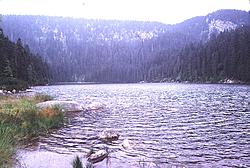
Mt. Plechý and Lake Plešné
Jiráskova 150
38226 Horní Planá
Contact: Správa Národního parku a Chráněné krajinné oblasti Šumava
Telephone: +420 380 738 628
Fax: +420 388 413 019
E-mail: vimperk@npsumava.cz
WWW: www.npsumava.cz
Location: Region of Český Krumlov
Type: Nature, technical, military monuments
Altitude: Mt. Plechý 1378 m and Lake Plešné 1090 m above sea level
Lake Plešné is one of five glacial lakes on Czech side of Šumava. It has elliptical shape with length 540 m and width 150 m, area is 7,48 hectares and maximal depth 18,3 m. About 200 meters from the lake dike is situated 6 hectare stone sea with glacial origin. There is Lake Cliff at the lake which is approx. 330 meter high.
In 1876-1877 there was constructed Stifter Monument on the platform upon the lake made of Šumava granite. From there is outlook over the lake, Šumava foothills and also Lipno area. Nearby the lake is Mt. Plechý (Plöckenstein), which is the highest mountain on the Czech side of Šumava (altitude 1378 m).
Accessibility by road:
Location: 13 km west from Horní Planá, 5 km from Nová Pec


