
Hiking and Nordic Walking
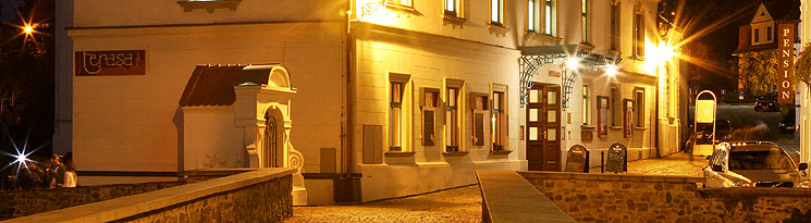
CA Vltava, Kájovská 62
38101 Český Krumlov
Contact: Cestovní agentura Vltava
Telephone: +420 380 711 988
Fax: +420 380 711 978
E-mail: ckvltava@ckvltava.cz
Location: Český Krumlov
Type: Tours around Český Krumlov
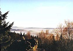
Deep forests, romantic cliffs, secret peat bogs, ancient forests, vast natural parks, the blue surface of ponds and Šumava lakes, archeological excavation sites, remains of celtic settlements, gothic ruins, Renaissance castles and chateaus, Baroque monasteries, churches, and chapels - all this and much more is awaiting you during your wanderings through the marvelous landscape of South Bohemia.
Nordic Walking
Nordic Walking is a new and very natural way of moving along. This is essentially walking with the aid of special poles and this easy movement can be practiced by everyone, from top sportsmen to beginners. We offer guided walks with a certified guide in the beautiful area around Český Krumlov for individuals and groups. Discounts available for tourist agencies.
Touristic Routes
Český Krumlov - Přídolí - Zahořánky - Rožmitál na Šumavě - Rožmberk nad Vltavou, 24.5 km
This route goes through sparsely populated countryside, through fields and some woods, and offers a number of breathtaking views. The route has no big elevations. The total length of this route is 24.5 km and estimated duration is 6 hours. This route is easy and goes along marked trails. As such it is suitable for families with children and for senior citizens.
Český Krumlov - Kájov - Slavkov - Zátoň - Spolí - Český Krumlov, 23.5 km
Between Český Krumlov and Kájov, the route is quite easy with a mild elevation and declines, with a number of nice views. From Kájov to Mezipotoční the route continues on a motorway. From Bohdalovice to Zátoň the route goes through a charming countryside. The total length of this route is 23.5 km and estimated duration is 6 hours. his route is easy and goes along marked trails. As such it is suitable for families with children and for senior citizens.
Brloh (Smědeč) - Kuklov - Vysoká Běta - Jaronín - Brloh, 20 km
From Smědeč or Brloh - on the road to the ruin of the castle and monastery Kuklov - continue by the blue line to the cross-roads with the red line (direction of Buglata) a continue by the red line - go under the Buglata mountain (842 m above sea level), continue on the blue line to the sign post pointing to the top of Vysoká Běta mountain (805 m above sea level) - return by the same route up to the meeting point with the red line - after another kilometre there is an unmarked path to Jaronín, from there 3 km to Brloh.
Bujanov - Castle Louzek - Dolní Dvořiště - Rybník
From Bujanov follow the yellow line through the village Zdíky to Castle Louzek - then take the blue line via Všeměřice to Rychnov nad Malší - the red line to Dolní Dvořiště - on road to Rybník.
Čertova stěna - Rožmberk nad Vltavou, 19 - 22 km
From the bus-stop near the nationally protected Rock Formations Čertova stěna and Luč, by road to Loučovice - continue along the green line (begins in Loučovice behind the paper factory) in the direction of Vyšší Brod (go through the valley of "Devil's streams") to the railway station "Čertova stěna" - the marking turns to the road, on this road along the level reservoir Lipno II to Vyšší Brod - on the road via Hrudkov (9 km) or take the red line via Kravín (796 m above sea level) (12.5 km) to Rožmberk nad Vltavou.
Frymburk - Svatý Tomáš - Vítkův Kámen - Přední Výtoň - Frymburk, 16 km
From Frymburk by ferry to Frýdava (Předmostí) - by the yellow line up 2 km to the cross-roads under Bukový hill, join the red line and continue to the village Svatý Tomáš (Gothic church) - up to the ruin of Vítkův Kámen (sometimes called Vítek´s Castle, Gothic castle), and back to Svatý Tomáš - continue by the red line to Přední Výtoň, from there take the unmarked road following the shore of the Lipno lake back to Frýdava, and ferry back to Frymburk.
Horní Planá - Bližší Lhota - Huťský Dvůr - Zadní Zvonková - Horní Planá, 17 km
By ferry from Horní Planá to Bližší Lhota - by the green line up around the Lhotský hill - continue on the road around the former Schwarzenberg Navigational Canal, on the unmarked path through the former village Josefův Důl to Medvědí les (Bear forest) and Zadní Zvonková - from there continue by the red line around Zvonkovský hill and after 2 km you are in Přední Zvonková - leave the red line and take the unmarked road to the water tank, via Zadní Hamry back to Bližší Lhota - ferry to Horní Planá.
Horní Planá - Černá v Pošumaví - Hořice na Šumavě, 15 km
From Horní Planá up the square to the playground, by the blue line to Černá v Pošumaví - continue to Muckov, in front of which there are interesting caves (former stone mines) on the left in the forest (50 m) - from Muckov by the yellow line to Hořice na Šumavě.
Chvalšiny - Červený Dvůr - Kleť - Český Krumlov, 16 km
From Chvalšiny by the red line to the former Castle Červený Dvůr (today detoxification sanitorium) and continue on the red to the top of the Kleť mountain (1084 m above sea level, on the top the oldest view tower in Bohemia, a restaurant, an observatory, and a TV transmitter) - from Kleť down by the red and yellow lines to the blue line, and by the blue line to Nový Dvůr, on the green line to Český Krumlov.
Kamenná - Žumberk - Děkanské Skaliny - Ličov
From the village Kamenná (near Benešov nad Černou in the direction of Trhové Sviny) on the blue line to Žumberk (fortificated village with a fortress) - on the yellow line via Kondrač and Klení to the saddle under Kohout - by the green line to the top of Kohout (870 m above sea level) with a view tower - return to the saddle - by the red line in the direction of Kaplice to Děkanské Skaliny - take the asphalt road to Ličov.
Lipno nad Vltavou - Frymburk, 10 km
From Lipno nad Vltavou follow the yellow line in the direction of Frymburk via Alpská view (on the 3rd kilometre) and Kaliště (993 m).
Lipno nad Vltavou - Loučovice - Vyklestilka - Kapličky - Lipno nad Vltavou, 15km
From Lipno nad Vltavou by the green line to the dike of the dam, from there to the railway station, and on the left shore of the Vltava river to Loučovice - go through the Village and from the railway station turn to the yellow line - cross the Vltava and up the Vyklestilka mountain (887 m above sea level), from there by the red line continue on the ridge to the Uhlíř hill and the reservation called peat-bog Kapličky - go up the large meadow, where the village Kapličky used to stand - by the blue line to a place called U Překopané hráze, and continue to the Medvědí mountain, planted with trees - down to the turning to Čertovo kopyto, cross to the left shore and back to the village Lipno nad Vltavou.
Malonty - Desky - Benešov nad Černou, 15 km
From Malonty by the path to Meziříčí, and left in the direction of the village Desky, continue on the main road to Dluhošť and by the yellow line to the right to Benešov nad Černou.
Nové Hrady - Terčino údolí - Cuknštejn - Kraví hora - Benešov nad Černou, 20 km
From Nové Hrady (museum in the old castle) go through Terčino údolí (a valley, protected park with precious wood trees) via Cuknštejn, Horní Stropnice, Dobrá Voda, Hojná Voda to the top of the Kraví mountain (952 m above sea level) - still by the red line pass the rock formation Napoleon and continue on the ridge via the Kuní mountain, Cikánka and Zaječí mountain to Benešov nad Černou.
Rožmberk nad Vltavou - Malšín - Loučovice, 16 km
From Rožmberk nad Vltavou - take the blue line (direction Frymburk) around the village Přířez, via Větrná to Malšín - the village Ostrov and on the yellow line via Kyselov and Dvorečná to the place where the yellow line meets the blue line - continue either by the blue via Luč (933 m) to Loučovice (5 km), or by the yellow line to Lipno (2 km).
St. Jacob Route
The first part of this journey leads from Český Krumlov to Šumava (27 km). The route begins in Český Krumlov and leads to Kájov. This is the location of one of South Bohemia's most recognized Gothic pilgrimage churches dedicated to the Virgin Mary. Fairs dedicated the the Virgin Mary have been taking place here since 1263. From Kájov the journey continues to Světlík, located on an elevated plateau with a good view of the countryside. This little village is dominated by a neo-Gothic church with origins going back to the 13th century. From Slavkov the journey goes to Frymburk - a village on the shores of the Lipno lake with the church of St. Bartholomew. From there you need to take a ferry across the lake. The second part of the journey is a steep climb up the Šumava hills (10 km). Přední Výtoň with its neo-Gothic church of St. Philip and Jacob is the starting point. The journey continues to Vítkův Hrádek with its originally gothic pilgrim church of St. Thomas. The journey continues along the walking trail through the forest downhill to the border crossing of Koranda/St. Oswald.
Velešín - Pořešín - Kaplice, 19 km
From the town hall in Velešín turn left to the road leading to Svatý Jan nad Malší - behind Velešín on the first cross-roads turn right to the asphalt road, via the village Pořešín to the ruin of the Castle Pořešín - continue by the blue line down to the bank of the river Malše (rapids) - continue on the blue line against the current, around the confluence with the river Černá to Kaplice.
Větřní - Slavkov - Pasovary - Světlík, 9 km
From Větřní on the main road up to a narrow asphalt road leading to a farm track - continue on a wide road, right up to the top of the hill above the village Kaliště - go through the village, and take the path leading to the saddle above Slavkov (in the village there is an old Fortified Settlement Slavkov) - on the blue line in the direction of Světlík - after 3 km turn to the Fortified Settlement Pasovary ( about 500 m) - return to the blue line and continue to Světlík.
Věžovatá Pláně - Rožmitál na Šumavě - Zátoň, 23 km
From Věžovaté Pláně on the red line in the direction of Kaplice - through the forest to the destroyed village Rojov - in front of the ruins right to the non marked path, and on it to the road - left to the area of the destroyed village Zahrádka (sign posts on the linden tree), continue on the blue line via Močerady to Rožmitál na Šumavě - at the top end of the village turn left on to a unmarked path, which leads through Čeřín to the Vltava river - in front of the bridge turn right, on the red line to Zátoň.